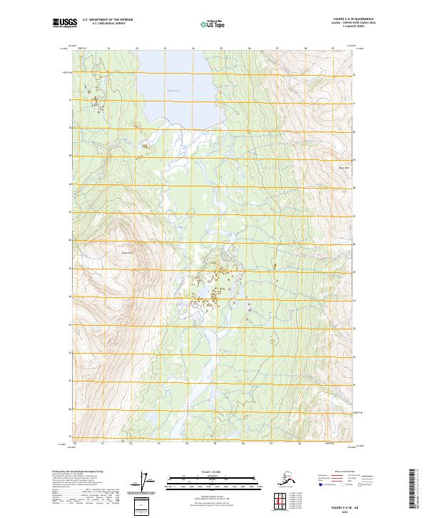
2023 Map of Valdez C-6 SE
USGS Topo · Published 2023About this map
Klutina Lake dominates the northern boundary of this 2023 survey, serving as the source for the south-flowing Klutina River. This portion of the Valdez quadrangle captures the dramatic transition from glacial lake to river valley, flanked by high-elevation terrain including Mayer Peak and Bence Mtn. The river follows a braiding path through the center of the sheet, while the Hallet River joins the system from the west. This modern topographic study by the U.S. Geological Survey provides precise elevation data for this corner of the Copper River Census Area, illustrating the complex hydrology where mountain runoff feeds the larger river basins. The lack of built infrastructure reflects the remote character of this landscape, where natural drainage patterns and mountain summits are the primary landmarks.
Find a feature on this map
9 named features on this map. Tap any name to fly to it.
Don’t see what you’re looking for? This feature index may not catch every label — zoom into the map to look around manually.
Map Details
Editions of this 2023 Valdez C-6 SE Map
This is the sole edition of this map. No revisions or reprints were ever made.
Other maps of this area

1950 · Valdez C-6
USGS Topo · 1:63,360

1951 · Valdez B-5
USGS Topo · 1:63,360

1951 · Valdez C-5
USGS Topo · 1:63,360

1951 · Valdez B-6
USGS Topo · 1:63,360

1952 · Valdez
USGS Topo · 1:250,000

1953 · Valdez C-6
USGS Topo · 1:63,360

1953 · Valdez C-5
USGS Topo · 1:63,360

1953 · Valdez B-6
USGS Topo · 1:63,360

1960 · Valdez
USGS Topo · 1:250,000
1993 · Valdez C-6
USGS Topo · 1:63,360