Loading...
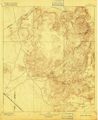
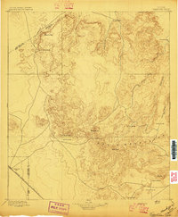
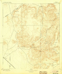
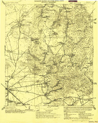
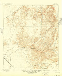
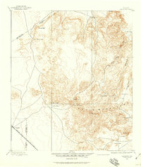
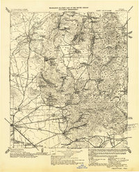
Loading map...1897 Map of Valentine
USGS Topo · Published 1916About this map
The high-altitude ranching and rail landscape of West Texas is documented here just before the turn of the century. The Southern Pacific R. R. cuts through the southwest corner, serving the station at Valentine, while the remainder of the terrain is defined by the massive peaks of the Davis Mountains. Prominent elevations like Sawtooth Mt. and Baldy Peak rise above a network of deep drainage systems, including Cherry Canyon and Madera Canyon.
Find a feature on this map
25 named features on this map. Tap any name to fly to it.
Don’t see what you’re looking for? This feature index may not catch every label — zoom into the map to look around manually.
Map Details
Date Portrayed1897
Date Published1916
PublisherU.S. Geological Survey
Map TypeTopographic
Scale1:125,000
Physical Dimensions16.2 x 19.9 inches
Editions of this 1897 Valentine Map
6 editions found

Historical Maps of Valentine Through Time
3 maps found
Featured Locations
Source Details
SourceU.S. Geological Survey
CopyrightPublic Domain