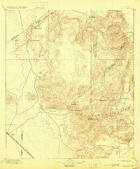
1897 Map of Valentine
USGS Topo · Published 1929About this map
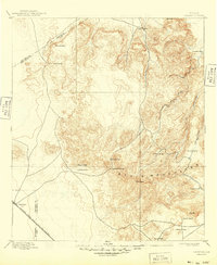
The high desert and volcanic peaks of the Davis Mountains dominate this late nineteenth-century landscape, providing a snapshot of the Trans-Pecos frontier before modern development. At the southwestern edge of the survey, the settlement of Valentine serves as a vital railroad station along the Southern Pacific R. R., marking the link between the high plains and the Pacific coast.
Find a feature on this map
26 named features on this map. Tap any name to fly to it.
Don’t see what you’re looking for? This feature index may not catch every label — zoom into the map to look around manually.
Map Details
Editions of this 1897 Valentine Map
6 editions found
Other maps of this area

1892 · Chispa
USGS Topo · 1:125,000

1894 · Valentine
USGS Topo · 1:125,000

1894 · Fort Davis
USGS Topo · 1:125,000

1895 · Chispa
USGS Topo · 1:125,000

1895 · Marfa
USGS Topo · 1:125,000

1895 · Alpine
USGS Topo · 1:125,000

1896 · San Carlos
USGS Topo · 1:125,000

1897 · Valentine
USGS Topo · 1:125,000

1897 · Fort Davis
USGS Topo · 1:125,000

1897 · Chispa
USGS Topo · 1:125,000