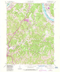
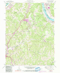
1957 Map of Valley Mills
USGS Topo · Published 1987About this map
Ohio River commerce and the rolling interior of Williams and Union districts define this mid-century landscape. The riverfront features vital transportation infrastructure, including the B & O RR and Old Lock No 17, while the northern reaches show the specialized grounds of the Marietta State Forest Nursery. Modern developments such as the Wood County Airport and a Drive-in Theater appear alongside older community hubs like Valley Mills and Waverly.
Find a feature on this map
68 named features on this map. Tap any name to fly to it.
Don’t see what you’re looking for? This feature index may not catch every label — zoom into the map to look around manually.
Map Details
Editions of this 1957 Valley Mills Map
5 editions found
Other maps of this area

1902 · Parkersburg
USGS Topo · 1:62,500

1904 · Parkersburg
USGS Topo · 1:62,500

1904 · Marietta
USGS Topo · 1:62,500

1906 · Elizabeth
USGS Topo · 1:62,500

1906 · Belleville
USGS Topo · 1:62,500

1924 · Belleville
USGS Topo · 1:62,500

1924 · Marietta
USGS Topo · 1:62,500

1924 · Elizabeth
USGS Topo · 1:62,500

1926 · Elizabeth
USGS Topo · 1:62,500

1926 · Belleville
USGS Topo · 1:62,500