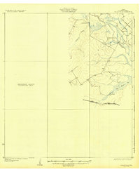
1932 Map of Valley Wells
USGS Topo · Published 1932About this map
Valley Wells and its surrounding ranchlands emerge from this 1932 topographic study, which highlights a distinctive period of South Texas development where the Nueces River valley transitions into surveyed terrain. The map is notably divided, featuring a detailed eastern section against a western expanse labeled as a Preliminary Edition Unsurveyed Area. This division offers a unique look at the progress of the Board of Water Engineers as they mapped the hydrology of the region, including Appurceon Creek and the marshy margins of San Roque Lake.
Find a feature on this map
11 named features on this map. Tap any name to fly to it.
Don’t see what you’re looking for? This feature index may not catch every label — zoom into the map to look around manually.
Map Details
Editions of this 1932 Valley Wells Map
2 editions found
Other maps of this area

1925 · San Roque Lake 1-a
USGS Topo · 1:48,000

1927 · Bart
USGS Topo · 1:62,500

1929 · Cotulla
USGS Topo · 1:125,000

1932 · Valley Wells
USGS Topo · 1:62,500

1939 · Carrizo Springs
USGS Topo · 1:62,500

1939 · Big Wells
USGS Topo · 1:62,500

1940 · Asherton
USGS Topo · 1:62,500

1940 · Velenzuela Creek
USGS Topo · 1:62,500

1940 · San Loranzo Creek
USGS Topo · 1:62,500

1940 · Catarina
USGS Topo · 1:62,500