
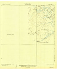
1932 Map of Valley Wells
USGS Topo · Published 1932About this map
The Nueces River winds through this South Texas landscape, defining the topography of the Valley Wells quadrangle during the mid-1920s. This survey, published by the Board of Water Engineers and the U.S. Geological Survey, highlights a ranching economy centered around family-named outposts such as Rasmussen Ranch and Buckhorn Ranch. The presence of San Roque Lake and the drainage of San Roque Cr and Appurceon Creek indicate a region where water management was critical to the semi-arid environment. Infrastructure is concentrated in the northeast and south, with the Kings Missouri Pacific Highway and Big Wells Road providing the primary transit corridors through the brush country. Large sections of the sheet remain designated as a Preliminary Edition Unsurveyed Area, reflecting the transitional state of mapping efforts in Dimmit County at this time.
Find a feature on this map
11 named features on this map. Tap any name to fly to it.
Don’t see what you’re looking for? This feature index may not catch every label — zoom into the map to look around manually.
Map Details
Editions of this 1932 Valley Wells Map
2 editions found
Other maps of this area

1925 · San Roque Lake 1-a
USGS Topo · 1:48,000

1927 · Bart
USGS Topo · 1:62,500

1929 · Cotulla
USGS Topo · 1:125,000

1939 · Carrizo Springs
USGS Topo · 1:62,500

1939 · Big Wells
USGS Topo · 1:62,500

1940 · Asherton
USGS Topo · 1:62,500

1940 · Velenzuela Creek
USGS Topo · 1:62,500

1940 · San Loranzo Creek
USGS Topo · 1:62,500

1940 · Catarina
USGS Topo · 1:62,500

1940 · Artesia Wells
USGS Topo · 1:62,500