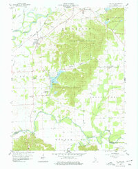
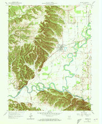
1959 Map of Vallonia
USGS Topo · Published 1960About this map
The East Fork White River and Muscatatuck River define the northern and southern limits of this Jackson County landscape during the late 1950s. The historic settlement of Vallonia serves as a focal point, situated near the Baltimore and Ohio Railroad line that traverses the northern lowlands. Much of the central terrain is occupied by the expansive Jackson-Washington State Forest, where a Lookout Tower stands above the ridges overlooking Starve Hollow Lake.
Find a feature on this map
40 named features on this map. Tap any name to fly to it.
Don’t see what you’re looking for? This feature index may not catch every label — zoom into the map to look around manually.
Map Details
Editions of this 1959 Vallonia Map
4 editions found
Other maps of this area

1951 · Smedley
USGS Topo · 1:24,000

1953 · Kossuth
USGS Topo · 1:24,000

1956 · Vincennes
USGS Topo · 1:250,000

1956 · Louisville
USGS Topo · 1:250,000

1957 · Vincennes
USGS Topo · 1:250,000

1958 · Vincennes
USGS Topo · 1:250,000

1958 · Little York
USGS Topo · 1:24,000

1958 · Brownstown
USGS Topo · 1:24,000

1958 · Seymour
USGS Topo · 1:24,000
1959 · Medora
USGS Topo · 1:24,000