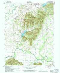
1959 Map of Vallonia
USGS Topo · Published 1994About this map
Jackson-Washington State Forest dominates the center of this landscape, its wooded ridges rising above the surrounding agricultural valleys of the White River and Muscatatuck River. The historic settlement of Vallonia serves as a focal point in Driftwood township, while smaller communities like Millport and Wegan anchor the rural sections. Local history is deeply etched into the map through numerous family-named landmarks and institutions, including the Burrell Cem, Miller Cem, and St Pauls Sch. The presence of the Miller Lookout Tower and the County Fairgrounds near Brownstown highlights the area's mix of public forestry and civic life. Water management is evident through a network of ditches like the Singer Ditch and Cammie Thomas Ditch, which drain the lowlands between the forest and the meandering river forks.
Find a feature on this map
41 named features on this map. Tap any name to fly to it.
Don’t see what you’re looking for? This feature index may not catch every label — zoom into the map to look around manually.
Map Details
Editions of this 1959 Vallonia Map
4 editions found
Other maps of this area

1951 · Smedley
USGS Topo · 1:24,000

1953 · Kossuth
USGS Topo · 1:24,000

1956 · Vincennes
USGS Topo · 1:250,000

1956 · Louisville
USGS Topo · 1:250,000

1957 · Vincennes
USGS Topo · 1:250,000

1958 · Vincennes
USGS Topo · 1:250,000

1958 · Little York
USGS Topo · 1:24,000

1958 · Brownstown
USGS Topo · 1:24,000

1958 · Seymour
USGS Topo · 1:24,000
1959 · Vallonia
USGS Topo · 1:24,000