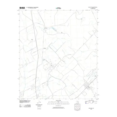
2010 Map of Van Vleck
USGS Topo · Published 2010About this map
Van Vleck anchors the southeastern corner of this Matagorda County landscape, where the coastal prairie meets an intricate network of waterways and industrial activity. The presence of the Bay City Oil Field and the Armour Oil Field underscores the region's reliance on mineral extraction, while the AG Aviation Airport reflects the ongoing importance of large-scale agriculture. Small named clusters like Chalmers, McCroskey, and Camp Pierce are connected by a web of local routes including Runnells Pierce Rd and Old Van Vleck Rd.
Find a feature on this map
31 named features on this map. Tap any name to fly to it.
Don’t see what you’re looking for? This feature index may not catch every label — zoom into the map to look around manually.
Map Details
Editions of this 2010 Van Vleck Map
This is the sole edition of this map. No revisions or reprints were ever made.
Other maps of this area

1950 · Houston
USGS Topo · 1:250,000

1951 · Bay City
USGS Topo · 1:250,000

1952 · Danciger
USGS Topo · 1:24,000

1952 · Ashwood
USGS Topo · 1:24,000

1952 · Lane City SE
USGS Topo · 1:24,000

1952 · Pledger
USGS Topo · 1:24,000

1952 · Bay City
USGS Topo · 1:24,000

1952 · Markham
USGS Topo · 1:24,000

1952 · Bay City NE
USGS Topo · 1:24,000

1952 · Lane City
USGS Topo · 1:24,000