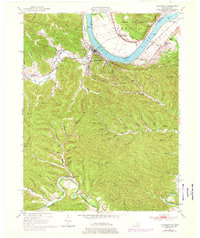
1949 Map of Vanceburg
USGS Topo · Published 1976About this map
Vanceburg serves as the focal point of this river-centered landscape, situated at a sharp bend in the Ohio River where the Chesapeake and Ohio railroad tracks follow the southern bank. This mid-century view reveals a community deeply integrated with its drainage network, from the wide Salt Lick Creek valley to the winding course of Kinniconick Creek in the south. The map documents numerous rural institutions critical to the era's social fabric, including the Lewis County Infirmary and the Drive-in Theater near the town center.
Find a feature on this map
82 named features on this map. Tap any name to fly to it.
Don’t see what you’re looking for? This feature index may not catch every label — zoom into the map to look around manually.
Map Details
Editions of this 1949 Vanceburg Map
4 editions found
Other maps of this area

1915 · Garrison
USGS Topo · 1:62,500

1918 · Garrison
USGS Topo · 1:62,500

1919 · Vanceburg
USGS Topo · 1:62,500

1949 · Pond Run
USGS Topo · 1:24,000

1949 · Vanceburg
USGS Topo · 1:62,500

1949 · Garrison
USGS Topo · 1:24,000

1949 · Buena Vista
USGS Topo · 1:24,000

1949 · Vanceburg
USGS Topo · 1:24,000

1949 · Concord
USGS Topo · 1:24,000

1949 · Charters
USGS Topo · 1:24,000