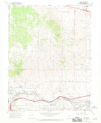
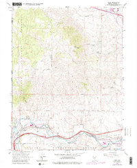
1967 Map of Verdi
USGS Topo · Published 1970About this map
Peavine Peak dominates the high desert terrain of the Toiyabe National Forest, marking a landscape defined by its transition from the Sierra Nevada into the Great Basin. This 1967 survey documents the critical transportation corridor where the Western Pacific and Southern Pacific railroads parallel the Truckee River, shaping the growth of Verdi and the neighboring settlements of Mogul and Lawton. The map captures a moment of varied land use, from the industrial remnants at the Poeveille (Site) and the Golden Fleece Mine to modern infrastructure like the Fish Hatchery and numerous pipelines. Local civic life is anchored by the Verdi Sch and Stead Sch, while the presence of the Nevada Central Mine and Red Metal Mine reflects the area's deep-rooted mining history along the slopes leading into Lemmon Valley.
Find a feature on this map
44 named features on this map. Tap any name to fly to it.
Don’t see what you’re looking for? This feature index may not catch every label — zoom into the map to look around manually.
Map Details
Editions of this 1967 Verdi Map
5 editions found
Other maps of this area

1890 · Sierraville
USGS Topo · 1:125,000

1891 · Carson
USGS Topo · 1:125,000

1891 · Truckee
USGS Topo · 1:125,000

1891 · Reno
USGS Topo · 1:125,000

1892 · Sierraville
USGS Topo · 1:125,000

1893 · Carson
USGS Topo · 1:125,000

1893 · Truckee
USGS Topo · 1:125,000

1893 · Reno
USGS Topo · 1:125,000

1894 · Sierraville
USGS Topo · 1:125,000

1895 · Truckee
USGS Topo · 1:125,000