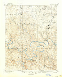
1893 Map of Versailles
USGS Topo · Published 1947About this map
The Osage River and its major tributaries, the Niangua River and Grandglaize Creek, dominate this late 19th-century landscape long before the creation of Lake of the Ozarks. At this time, Linn Creek sits at the confluence of the rivers, and Bagnell serves as a key river-bound settlement before the era of major dam construction. The presence of the Osage Iron Works on Bolinger Creek speaks to the early industrial ventures of the Ozark hills, while the Missouri Pacific Railroad connects the northern county seat of Versailles to the wider region. To the east, the rail line stimulates growth in towns like Eldon and Aurora Springs. The map reveals a highly dissected terrain of ridges and hollows, such as Anderson Hollow, populated by small agricultural and milling centers including Gravois Mills and Barnettsville which served the local farming communities of Morgan and Camden counties.
Find a feature on this map
64 named features on this map. Tap any name to fly to it.
Don’t see what you’re looking for? This feature index may not catch every label — zoom into the map to look around manually.
Map Details
Editions of this 1893 Versailles Map
4 editions found
Other maps of this area

1884 · Bolivar
USGS Topo · 1:125,000

1886 · Jefferson City
USGS Topo · 1:125,000

1887 · Sedalia
USGS Topo · 1:125,000

1887 · Warsaw
USGS Topo · 1:125,000

1888 · Versailles
USGS Topo · 1:125,000

1888 · Tuscumbia
USGS Topo · 1:125,000

1888 · Boonville
USGS Topo · 1:125,000

1892 · Bolivar
USGS Topo · 1:125,000

1893 · Versailles
USGS Topo · 1:125,000

1894 · Warsaw
USGS Topo · 1:125,000