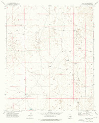
1973 Map of Vest Camp
USGS Topo · Published 1976About this map
Vest Camp sits within the high-plains landscape of eastern New Mexico, serving as a primary point of reference in an area defined by ranching and resource exploration. This 1973 survey reveals a terrain marked by scattered water sources like Brooks Tank and the North Windmill, which were essential for maintaining livestock in this arid environment. The presence of numerous Drill Hole locations and a Gravel Pit indicates the geological surveying and extraction efforts common in Chaves County during this era. A network of Jeep Trails provides the only access through the section lines, tracing the movement of ranchers and energy workers across the landscape. The map captures a moment when the transition from traditional grazing to more industrial land use was clearly etched into the local geography.
Find a feature on this map
9 named features on this map. Tap any name to fly to it.
Don’t see what you’re looking for? This feature index may not catch every label — zoom into the map to look around manually.
Map Details
Editions of this 1973 Vest Camp Map
2 editions found
Other maps of this area

1949 · Malstrom Ranch
USGS Topo · 1:24,000

1951 · King Camp
USGS Topo · 1:24,000

1952 · Connor Well
USGS Topo · 1:24,000

1954 · Brownfield
USGS Topo · 1:250,000

1955 · Roswell
USGS Topo · 1:250,000

1958 · Brownfield
USGS Topo · 1:250,000

1958 · Roswell
USGS Topo · 1:250,000

1962 · Roswell
USGS Topo · 1:250,000

1962 · Brownfield
USGS Topo · 1:250,000

1973 · Culp Ranch
USGS Topo · 1:24,000