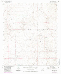
1973 Map of Vest Camp
USGS Topo · Published 1985About this map
Vest Camp sits at the heart of this high-plains landscape in Chaves County, where survival and industry are dictated by water and mineral extraction. This 1973 field survey, updated in the early 1980s, reveals a network of resource-related infrastructure including the North Windmill and Brooks Tank, which provided essential water points in a desert environment. The presence of numerous Drill Holes and a Gravel Pit scattered across the terrain indicates active exploration and industrial activity during this period. Navigation through the area relied heavily on a sparse network of Jeep Trails, underscoring the functional, work-oriented character of the region. This map serves as a clear record of land use and resource management in eastern New Mexico before later modern developments altered the local topography.
Find a feature on this map
9 named features on this map. Tap any name to fly to it.
Don’t see what you’re looking for? This feature index may not catch every label — zoom into the map to look around manually.
Map Details
Editions of this 1973 Vest Camp Map
2 editions found
Other maps of this area

1949 · Malstrom Ranch
USGS Topo · 1:24,000

1951 · King Camp
USGS Topo · 1:24,000

1952 · Connor Well
USGS Topo · 1:24,000

1954 · Brownfield
USGS Topo · 1:250,000

1955 · Roswell
USGS Topo · 1:250,000

1958 · Brownfield
USGS Topo · 1:250,000

1958 · Roswell
USGS Topo · 1:250,000

1962 · Roswell
USGS Topo · 1:250,000

1962 · Brownfield
USGS Topo · 1:250,000

1973 · Culp Ranch
USGS Topo · 1:24,000