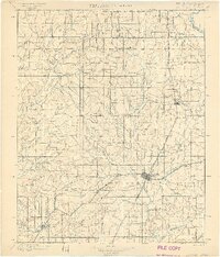
1901 Map of Vinita
USGS Topo · Published 1901About this map
Vinita serves as the primary junction point in the Cherokee Nation, where the Missouri Kansas and Texas RR and the St. Louis and San Francisco RR intersect. This rail crossing transformed the landscape from open prairie into a network of emerging shipping points and small agricultural centers. Settlements like Bluejacket, Welch, and Big Cabin follow the north-south rail corridor, while the western portion of the map is defined by a dense network of waterways including Big Creek, Lightning Creek, and Cabin Creek.
Find a feature on this map
60 named features on this map. Tap any name to fly to it.
Don’t see what you’re looking for? This feature index may not catch every label — zoom into the map to look around manually.
Map Details
Editions of this 1901 Vinita Map
2 editions found

Other maps of this area

1886 · Joplin
USGS Topo · 1:125,000

1886 · Independence
USGS Topo · 1:125,000

1886 · Parsons
USGS Topo · 1:125,000

1893 · Parsons
USGS Topo · 1:125,000

1894 · Independence
USGS Topo · 1:125,000

1894 · Joplin
USGS Topo · 1:125,000

1896 · Pryor
USGS Topo · 1:125,000

1899 · Siloam Springs
USGS Topo · 1:125,000

1901 · Claremore
USGS Topo · 1:125,000

1901 · Nowata
USGS Topo · 1:125,000