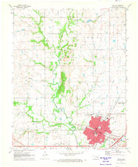
1913 Map of Vinita
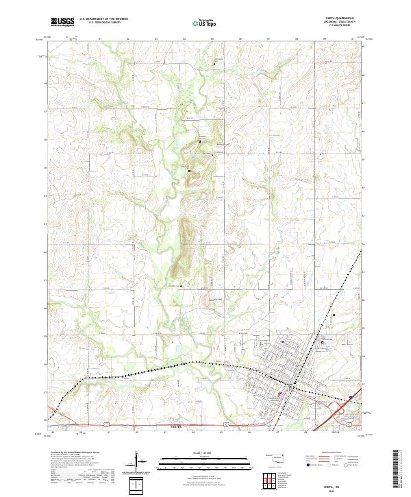
USGS Topo · Published 1939About this map
Vinita serves as the prominent rail hub of this 1910s landscape, positioned at the intersection of the St Louis and San Francisco RR and a north-south line. The northeastern Oklahoma territory is characterized by a dense network of early rural educational infrastructure, with dozens of named institutions such as Russell Creek School, Goldenrod School, and Grant Mound School serving the farming and ranching communities. The terrain transitions from the Neosho River valley in the east toward the prairies to the west, marked by distinctive landforms like Grant Mound and Timbered Hill. Small settlements like Welch, Centralia, and Chelsea anchor the various townships, which are surveyed into a tight grid. The map also reveals the early county structure, tracing the Oklahoma-Kansas Boundary Line at the northern edge and internal borders between Craig, Nowata, and Rogers counties.
Find a feature on this map
122 named features on this map. Tap any name to fly to it.
Don’t see what you’re looking for? This feature index may not catch every label — zoom into the map to look around manually.
Map Details
Editions of this 1913 Vinita Map
3 editions found

Historical Maps of Vinita Through Time
8 maps found