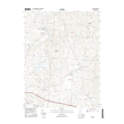
2016 Map of Vinton
USGS Topo · Published 2016About this map
Raccoon Creek and its many tributaries, including Robinson Run and Campaign Cr, wind through this Gallia County landscape, shaping the locations of early Ohio settlements like Vinton and Bidwell. The map reveals a dense network of family-named cemeteries and rural landmarks that speak to generations of local residency, from the Vinton Memorial Cem in the north to the Evergreen Cem near the southern boundary. The topography is defined by significant water bodies like Tycoon Lake and the Clark Chapel Acres Recreation Pond, which contrast with the scattered residential clusters at Harrisburg, Porter, and Adamsville. This survey provides a clear view of the area's rural character, where small communities like Morgan Center and Glen Summitt are connected by a web of township and county roads, such as Woods Mill Rd and Keaton Rd, that follow the natural contours of the stream valleys.
Find a feature on this map
130 named features on this map. Tap any name to fly to it.
Don’t see what you’re looking for? This feature index may not catch every label — zoom into the map to look around manually.
Map Details
Editions of this 2016 Vinton Map
This is the sole edition of this map. No revisions or reprints were ever made.
Other maps of this area

1905 · Wilkesville
USGS Topo · 1:62,500

1906 · Bidwell
USGS Topo · 1:62,500

1907 · Pomeroy
USGS Topo · 1:62,500

1908 · Bidwell
USGS Topo · 1:62,500

1908 · Point Pleasant
USGS Topo · 1:62,500

1908 · Wilkesville
USGS Topo · 1:62,500

1926 · Point Pleasant
USGS Topo · 1:62,500

1929 · Point Pleasant
USGS Topo · 1:62,500

1947 · Columbus
USGS Topo · 1:250,000

1957 · Huntington
USGS Topo · 1:250,000