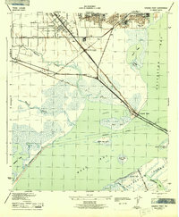
1943 Map of Virginia Point
USGS Topo · Published 1943About this map
The industrial and maritime corridors of Galveston County take center stage in this mid-war study by the War Department and the Tennessee Valley Authority. Rapid development is evident in the rail-heavy landscape around Lamarque and Texas City, where the Texas City Terminal and Southern Pacific lines converge to feed the coastal ports. The map captures the vital transportation link at Virginia Point, where the Galveston Causeway bridges the gap between the mainland and Galveston Island.
Find a feature on this map
27 named features on this map. Tap any name to fly to it.
Don’t see what you’re looking for? This feature index may not catch every label — zoom into the map to look around manually.
Map Details
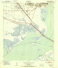
Editions of this 1943 Virginia Point Map
2 editions found
Other maps of this area

1929 · Dickinson
USGS Topo · 1:24,000

1929 · Karankawa Lake
USGS Topo · 1:24,000

1929 · Hitchcock
USGS Topo · 1:24,000

1929 · Virginia Point
USGS Topo · 1:24,000

1929 · Texas City
USGS Topo · 1:24,000

1930 · Galveston
USGS Topo · 1:24,000

1931 · Lake Como
USGS Topo · 1:24,000

1932 · Dickinson
USGS Topo · 1:31,680

1932 · Texas City
USGS Topo · 1:31,680

1932 · Bolivar Point
USGS Topo · 1:24,000