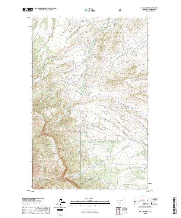
2024 Map of Volcano Reef
USGS Topo · Published 2024About this map
The Sawtooth Range rises sharply across this landscape, where the high plains of the Blackfoot Valley Conservation Area meet the eastern front of the Rocky Mountains. This 2024 survey documents a complex network of drainage systems, including the North Fork Dupuyer Creek and the Middle Fork Dry Fork Marias River, which carve through the foothills. The area is defined by significant conservation and wilderness protections, with the Bob Marshall Wilderness and Lewis & Clark National Forest covering the western portions of the quadrangle.
Find a feature on this map
36 named features on this map. Tap any name to fly to it.
Don’t see what you’re looking for? This feature index may not catch every label — zoom into the map to look around manually.
Map Details
Editions of this 2024 Volcano Reef Map
This is the sole edition of this map. No revisions or reprints were ever made.
Other maps of this area

1903 · Saypo
USGS Topo · 1:125,000

1914 · Heart Butte
USGS Topo · 1:125,000

1918 · Heart Butte
USGS Topo · 1:125,000

1955 · Choteau
USGS Topo · 1:250,000

1957 · Choteau
USGS Topo · 1:250,000

1958 · Choteau
USGS Topo · 1:250,000

1958 · Cave Mountain
USGS Topo · 1:24,000

1958 · Mount Wright
USGS Topo · 1:24,000
1958 · Twin Lakes
USGS Topo · 1:24,000

1960 · Cut Bank
USGS Topo · 1:250,000