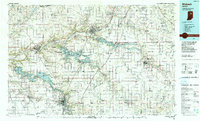
1986 Map of Wabash
USGS Topo · Published 1990About this map
Wabash River and Salamonie River drainage basins define the topography of this mid-1980s landscape across several Indiana counties. This era reveals a region balanced between its agricultural roots and expansive state-managed lands, featuring the massive Mississinewa Lake and the Salamonie River State Wildlife Management and Recreation Area. These reservoirs, managed alongside the Frances Slocum State Forest, transformed the local environment from traditional river valleys into major recreation hubs while preserving the surrounding timberlands.
Find a feature on this map
142 named features on this map. Tap any name to fly to it.
Don’t see what you’re looking for? This feature index may not catch every label — zoom into the map to look around manually.
Map Details
Editions of this 1986 Wabash Map
2 editions found
Other maps of this area

1911 · Berne
USGS Topo · 1:48,000

1915 · Fort Recovery
USGS Topo · 1:48,000

1918 · Fort Recovery
USGS Topo · 1:62,500

1950 · Lagro
USGS Topo · 1:24,000

1950 · Andrews
USGS Topo · 1:24,000

1950 · Warren
USGS Topo · 1:24,000

1950 · Mount Etna
USGS Topo · 1:24,000

1951 · Peru
USGS Topo · 1:24,000

1951 · Mount Etna
USGS Topo · 1:24,000

1951 · Andrews
USGS Topo · 1:24,000