
1954 Map of Waco
USGS Topo · Published 1964About this map
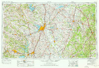
The Brazos River and its major tributaries, including the Bosque River and Little River, anchor this mid-century portrait of Central Texas. At the heart of the region, Waco appears as a burgeoning transportation hub where the Missouri-Kansas-Texas RR and St Louis Southwestern Ry intersect near Lake Waco. To the west, the massive footprint of the Fort Hood Military Reservation dominates the landscape between Killeen and Gatesville, highlighting the Cold War era's significant military infrastructure. This is further evidenced by a dense network of aviation facilities like James Connally Air Force Base and Gray Air Force Base. Moving east, the terrain transitions into the Blackland Prairie, dotted with agricultural centers such as Mexia and Marlin, while the newly formed Lake Whitney on the upper Brazos reflects the period's massive water management and flood control projects.
Find a feature on this map
145 named features on this map. Tap any name to fly to it.
Don’t see what you’re looking for? This feature index may not catch every label — zoom into the map to look around manually.
Map Details
Editions of this 1954 Waco Map
2 editions found
Other maps of this area

1885 · Taylor
USGS Topo · 1:125,000

1887 · Taylor
USGS Topo · 1:125,000

1887 · Lampasas
USGS Topo · 1:125,000

1887 · Burnet
USGS Topo · 1:125,000

1888 · Hamilton
USGS Topo · 1:125,000

1888 · Meridian
USGS Topo · 1:125,000

1889 · Granbury
USGS Topo · 1:125,000

1890 · Stephenville
USGS Topo · 1:125,000

1891 · Cleburne
USGS Topo · 1:125,000

1892 · Temple
USGS Topo · 1:125,000