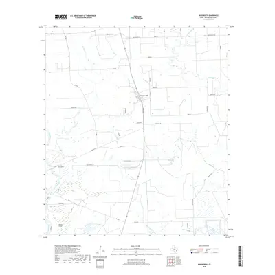
2019 Map of Wadsworth
USGS Topo · Published 2019About this map
Wadsworth sits at the heart of this coastal prairie landscape, a settlement defined by its grid of local streets like Main St and its proximity to the winding waters of Big Boggy Creek. The survey reveals a region shaped by both agricultural ranching and industrial development, with the Pitch Fork Ranch to the north and the heavy transport corridor of Cain Chemical Rd slicing across the southern lowlands. Along the western edge, the Colorado River creates a complex system of marshes and landmasses, including Dick Island and the larger Selkirk Island, where the river's path dictates the local road network. The map illustrates the hydrological transition from inland creeks like Peyton Creek toward the tidal influence of the Wadsworth Slough, capturing a modern era where traditional Texas ranching lives alongside large-scale industry.
Find a feature on this map
44 named features on this map. Tap any name to fly to it.
Don’t see what you’re looking for? This feature index may not catch every label — zoom into the map to look around manually.
Map Details
Editions of this 2019 Wadsworth Map
This is the sole edition of this map. No revisions or reprints were ever made.
Other maps of this area

1951 · Bay City
USGS Topo · 1:250,000

1952 · Lake Austin
USGS Topo · 1:24,000

1952 · Matagorda
USGS Topo · 1:24,000

1952 · Blessing SE
USGS Topo · 1:24,000

1952 · Dressing Point
USGS Topo · 1:24,000

1952 · Bay City
USGS Topo · 1:24,000

1952 · Markham
USGS Topo · 1:24,000

1952 · Bay City NE
USGS Topo · 1:24,000

1952 · Palacios NE
USGS Topo · 1:24,000

1952 · Wadsworth
USGS Topo · 1:24,000