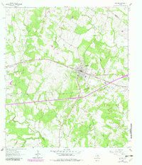
1964 Map of Waelder
USGS Topo · Published 1982About this map
The Southern Pacific railroad forms the central axis of this landscape, driving the development of Waelder in northeastern Gonzales County. The town is depicted as a compact grid of streets featuring community pillars like Waelder Sch, St Patricks Ch, and the City Cem. This 1964 survey, later updated with purple revisions, shows a rural economy transitioning through the mid-20th century, with numerous small farm structures and a network of creeks like Baldridge Creek and Pecan Creek providing natural drainage across the terrain.
Find a feature on this map
23 named features on this map. Tap any name to fly to it.
Don’t see what you’re looking for? This feature index may not catch every label — zoom into the map to look around manually.
Map Details
Editions of this 1964 Waelder Map
2 editions found
Other maps of this area

1901 · Flatonia
USGS Topo · 1:125,000

1953 · Seguin
USGS Topo · 1:250,000

1958 · Seguin
USGS Topo · 1:250,000

1962 · Dilworth
USGS Topo · 1:24,000
1962 · Gonzales North
USGS Topo · 1:24,000
1964 · Delhi
USGS Topo · 1:24,000
1964 · Sandy Fork
USGS Topo · 1:24,000

1964 · Waelder
USGS Topo · 1:24,000

1964 · Jeddo
USGS Topo · 1:24,000

1965 · Cistern
USGS Topo · 1:24,000