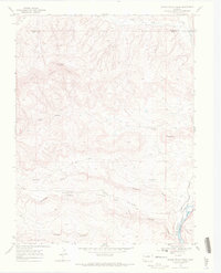
1968 Map of Wagon Track Ridge
USGS Topo · Published 1972About this map
The Colorado River corridor in western Colorado is defined here by its steep canyon walls and the critical transit corridor of the Denver and Rio Grande Western railroad. This 1968 survey reveals a landscape dominated by massive uplifted formations including South Shale Ridge and Wagon Track Ridge, which together create a complex system of drainage and erosion. The terrain is marked by distinctive landmarks such as Twin Peaks, Pyramid Rock, and Castle Rock, which served as natural navigational aids for those traversing the high desert.
Find a feature on this map
20 named features on this map. Tap any name to fly to it.
Don’t see what you’re looking for? This feature index may not catch every label — zoom into the map to look around manually.
Map Details
Editions of this 1968 Wagon Track Ridge Map
2 editions found
Other maps of this area

1929 · Grand Valley
USGS Topo · 1:62,500

1929 · Roan Creek
USGS Topo · 1:62,500

1955 · Cameo
USGS Topo · 1:24,000

1955 · Mesa
USGS Topo · 1:24,000

1956 · Grand Junction
USGS Topo · 1:250,000

1959 · Grand Junction
USGS Topo · 1:250,000

1960 · Grand Junction
USGS Topo · 1:250,000

1962 · Grand Junction
USGS Topo · 1:250,000
1962 · Red Pinnacle
USGS Topo · 1:24,000
1962 · De Beque
USGS Topo · 1:24,000