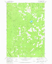
1979 Map of Wahtum Lake
USGS Topo · Published 1980About this map
Wahtum Lake serves as a central geographic anchor for this 1970s survey of the high country where Hood River and Multnomah counties meet. The landscape is defined by the convergence of the Pacific Crest National Scenic Trail and the Eagle Creek Trail, illustrating the era's established recreational infrastructure within the Mount Hood National Forest. Notable peaks such as Chinidere Mtn, Tomlike Mtn, and Buck Peak surround the central basin, while the western edge of the map features several notable cataracts including Tunnel Falls.
Find a feature on this map
59 named features on this map. Tap any name to fly to it.
Don’t see what you’re looking for? This feature index may not catch every label — zoom into the map to look around manually.
Map Details
Editions of this 1979 Wahtum Lake Map
2 editions found
Other maps of this area

1924 · Mount Hood
USGS Topo · 1:125,000

1926 · Hood River
USGS Topo · 1:125,000

1927 · Mount Hood
USGS Topo · 1:125,000

1929 · Hood River
USGS Topo · 1:125,000

1953 · The Dalles
USGS Topo · 1:250,000

1956 · The Dalles
USGS Topo · 1:250,000

1957 · The Dalles
USGS Topo · 1:250,000

1957 · Bonneville Dam
USGS Topo · 1:62,500

1957 · Hood River
USGS Topo · 1:62,500
1962 · Hickman Butte
USGS Topo · 1:24,000