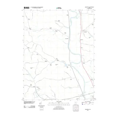
2010 Map of Wakefield
USGS Topo · Published 2010About this map
The Scioto River dominates the eastern corridor of this landscape, carving a wide valley that supports the primary transportation and settlement patterns near the southern border of Pike County. Communities such as Wakefield, Coopersville, and Wetmore are positioned along the river's path, while the western uplands are defined by a series of narrow hollows like Starr Hollow and Wheeler Hollow. The presence of numerous numbered burial sites, including Russell Number 2 Cemetery and Howard Number 2 Cemetery, suggests a long-standing pattern of rural family and community land use.
Find a feature on this map
75 named features on this map. Tap any name to fly to it.
Don’t see what you’re looking for? This feature index may not catch every label — zoom into the map to look around manually.
Map Details
Editions of this 2010 Wakefield Map
This is the sole edition of this map. No revisions or reprints were ever made.
Other maps of this area

1906 · Waverly
USGS Topo · 1:62,500

1908 · Waverly
USGS Topo · 1:62,500

1911 · Sciotoville
USGS Topo · 1:62,500

1913 · Sciotoville
USGS Topo · 1:62,500

1915 · Otway
USGS Topo · 1:62,500

1915 · Piketon
USGS Topo · 1:62,500

1917 · Piketon
USGS Topo · 1:62,500

1917 · Otway
USGS Topo · 1:62,500

1944 · Piketon
USGS Topo · 1:62,500

1947 · Columbus
USGS Topo · 1:250,000