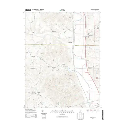
2013 Map of Wakefield
USGS Topo · Published 2013About this map
Scioto River dominates the eastern corridor of this landscape, its wide floodplain hosting the primary transportation routes and settlements of southeastern Ohio. The area is characterized by high, dissected ridges separated by numerous named hollows, including Wheeler Hollow, Starr Hollow, and Bean Hollow. These deep drainages feed into larger water bodies like Bear Cr and Camp Cr. Settlement patterns are concentrated along the valley floors, with small communities such as Coopersville, Wakefield, and Wetmore serving as local hubs.
Find a feature on this map
97 named features on this map. Tap any name to fly to it.
Don’t see what you’re looking for? This feature index may not catch every label — zoom into the map to look around manually.
Map Details
Editions of this 2013 Wakefield Map
This is the sole edition of this map. No revisions or reprints were ever made.
Other maps of this area

1906 · Waverly
USGS Topo · 1:62,500

1908 · Waverly
USGS Topo · 1:62,500

1911 · Sciotoville
USGS Topo · 1:62,500

1913 · Sciotoville
USGS Topo · 1:62,500

1915 · Otway
USGS Topo · 1:62,500

1915 · Piketon
USGS Topo · 1:62,500

1917 · Piketon
USGS Topo · 1:62,500

1917 · Otway
USGS Topo · 1:62,500

1944 · Piketon
USGS Topo · 1:62,500

1947 · Columbus
USGS Topo · 1:250,000