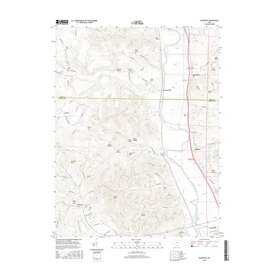
2016 Map of Wakefield
USGS Topo · Published 2016About this map
The Scioto River valley defines the eastern edge of this landscape, where the settlements of Wakefield, Coopersville, and Clifford are situated along the river's flat floodplains and primary transportation corridors. Moving west, the terrain rises into the dissected hills of the Appalachian Plateau, characterized by a dense network of hollows such as Starr Hollow, Wheeler Hollow, and Inskeep Hollow. This area is marked by a significant number of small, numbered family cemeteries, including Russell Number 2 Cem, Mount Zion Number 3 Cem, and Howard Number 2 Cem, providing valuable data for genealogists tracing early landholdings. Further south, the community of Crabtree and the Hidden Quarry Airport sit near the border between Pike and Scioto counties, while the northern edge of Lucasville appears at the bottom of the sheet, illustrating the transition from rural uplands to more concentrated valley settlements.
Find a feature on this map
109 named features on this map. Tap any name to fly to it.
Don’t see what you’re looking for? This feature index may not catch every label — zoom into the map to look around manually.
Map Details
Editions of this 2016 Wakefield Map
This is the sole edition of this map. No revisions or reprints were ever made.
Other maps of this area

1906 · Waverly
USGS Topo · 1:62,500

1908 · Waverly
USGS Topo · 1:62,500

1911 · Sciotoville
USGS Topo · 1:62,500

1913 · Sciotoville
USGS Topo · 1:62,500

1915 · Otway
USGS Topo · 1:62,500

1915 · Piketon
USGS Topo · 1:62,500

1917 · Piketon
USGS Topo · 1:62,500

1917 · Otway
USGS Topo · 1:62,500

1944 · Piketon
USGS Topo · 1:62,500

1947 · Columbus
USGS Topo · 1:250,000