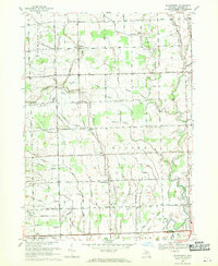
1968 Map of Waldenburg
USGS Topo · Published 1970About this map
The North Branch Clinton River and Middle Branch Clinton River define the hydraulic character of this corner of Macomb County, feeding an intricate network of named drainage systems like the Crittenden Drain and Heide Drain. In the late 1960s, the area maintained a distinct agrarian identity even as suburban expansion reached the southern border at Sterling Heights. Local life centered around intersections such as Waldenburg and Macomb, where institutions like St Peters Ch and Immanuel Sch stood as community anchors. The landscape is also marked by early aviation and leisure developments, including the Macomb Airport, small private runways like Higgs Landing Strip, and multiple recreational sites such as the Burning Tree Country Club.
Find a feature on this map
88 named features on this map. Tap any name to fly to it.
Don’t see what you’re looking for? This feature index may not catch every label — zoom into the map to look around manually.
Map Details
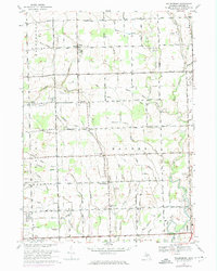
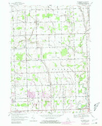
Editions of this 1968 Waldenburg Map
3 editions found
Other maps of this area

1908 · Rochester
USGS Topo · 1:62,500

1912 · Mt Clemens
USGS Topo · 1:62,500

1914 · Armada
USGS Topo · 1:62,500

1928 · Armada
USGS Topo · 1:62,500

1929 · Mt Clemens
USGS Topo · 1:62,500

1936 · Warren
USGS Topo · 1:31,680

1936 · New Haven
USGS Topo · 1:31,680

1936 · Washington
USGS Topo · 1:31,680

1936 · Waldenburg
USGS Topo · 1:31,680

1936 · Selfridge Field
USGS Topo · 1:31,680
Featured Places
- Sterling Heights, MI
- Clinton Township, MI
- Macomb Township, MI
- Shelby Charter Township, MI
- Washington Charter Township, MI