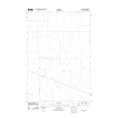
2012 Map of Walker
USGS Topo · Published 2012About this map
Walker is the primary settlement on this landscape, which straddles the border of North and South Dakota. The area is defined by the winding paths of Oak Cr and Rock Cr, which carve through the plains. The road network indicates a legacy of travel and administration, featuring the historically named Old Yellowstone Rd and Bureau Indian Affairs 16. This 2012 survey illustrates the grid-based development of the region, where routes like Founding Rd and 1st Ave E serve the local community. The mapping provides a clear record of the intersection between established thoroughfares and the natural hydrology of the Missouri River plateau.
Find a feature on this map
8 named features on this map. Tap any name to fly to it.
Don’t see what you’re looking for? This feature index may not catch every label — zoom into the map to look around manually.
Map Details
Editions of this 2012 Walker Map
This is the sole edition of this map. No revisions or reprints were ever made.
Other maps of this area

1953 · McIntosh
USGS Topo · 1:250,000

1954 · Bismarck
USGS Topo · 1:250,000

1956 · Bullhead
USGS Topo · 1:24,000

1956 · Bullhead SW
USGS Topo · 1:24,000

1958 · Bismarck
USGS Topo · 1:250,000

1958 · McIntosh
USGS Topo · 1:250,000

1971 · Shields SW
USGS Topo · 1:24,000

1971 · Selfridge
USGS Topo · 1:24,000

1971 · Pamplin Hills
USGS Topo · 1:24,000

1971 · McLaughlin SW
USGS Topo · 1:24,000
Featured Places
- Porcupine District, ND
- Rock Creek District, SD
- Walker, Rock Creek District
- Sioux County, ND
- Corson County, SD