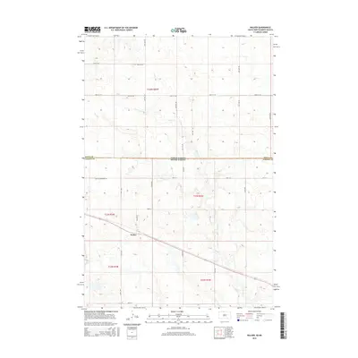
2015 Map of Walker
USGS Topo · Published 2015About this map
Walker sits at the intersection of local routes in the southern portion of this landscape, which spans the state line between North Dakota and South Dakota. The topography is defined by the winding paths of Rock Cr and Oak Cr, which carve through the prairie terrain in the Sioux and Corson county borderlands. The road network reflects a structured grid of rural section lines, including 101st St and 100th Sw, yet it is also marked by historical routes like Old Yellowstone Rd. This intersection of modern township roads and older thoroughfares illustrates the enduring patterns of transit and land division across this northern plains region. The map provides a detailed view of the drainage basins and elevation contours that have shaped local ranching and agricultural development for generations.
Find a feature on this map
16 named features on this map. Tap any name to fly to it.
Don’t see what you’re looking for? This feature index may not catch every label — zoom into the map to look around manually.
Map Details
Editions of this 2015 Walker Map
This is the sole edition of this map. No revisions or reprints were ever made.
Other maps of this area

1953 · McIntosh
USGS Topo · 1:250,000

1954 · Bismarck
USGS Topo · 1:250,000

1956 · Bullhead
USGS Topo · 1:24,000

1956 · Bullhead SW
USGS Topo · 1:24,000

1958 · Bismarck
USGS Topo · 1:250,000

1958 · McIntosh
USGS Topo · 1:250,000

1971 · Shields SW
USGS Topo · 1:24,000

1971 · Selfridge
USGS Topo · 1:24,000

1971 · Pamplin Hills
USGS Topo · 1:24,000

1971 · McLaughlin SW
USGS Topo · 1:24,000
Featured Places
- Porcupine District, ND
- Rock Creek District, SD
- Walker, Rock Creek District
- Sioux County, ND
- Corson County, SD