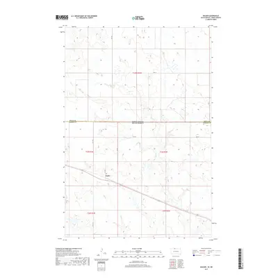
2017 Map of Walker
USGS Topo · Published 2017About this map
Walker sits at the heart of this prairie landscape, serving as a primary point of reference along the boundary of Sioux Co and Corson Co. This 2017 survey documents the modern layout of the North Dakota–South Dakota state line, illustrating how township and range lines like t23n r24e and t23n r25e organize the rural territory. The hydrology of the region is defined by the winding course of Rock Cr and the presence of Oak Cr further north, which carve subtle drainage patterns through the upland terrain. A grid of rural roads, including BIA Hwy 21 and 101st St, provides the essential infrastructure for this agricultural and ranching community, connecting isolated homesteads and sections across the state border.
Find a feature on this map
17 named features on this map. Tap any name to fly to it.
Don’t see what you’re looking for? This feature index may not catch every label — zoom into the map to look around manually.
Map Details
Editions of this 2017 Walker Map
This is the sole edition of this map. No revisions or reprints were ever made.
Other maps of this area

1953 · McIntosh
USGS Topo · 1:250,000

1954 · Bismarck
USGS Topo · 1:250,000

1956 · Bullhead
USGS Topo · 1:24,000

1956 · Bullhead SW
USGS Topo · 1:24,000

1958 · Bismarck
USGS Topo · 1:250,000

1958 · McIntosh
USGS Topo · 1:250,000

1971 · Shields SW
USGS Topo · 1:24,000

1971 · Selfridge
USGS Topo · 1:24,000

1971 · Pamplin Hills
USGS Topo · 1:24,000

1971 · McLaughlin SW
USGS Topo · 1:24,000
Featured Places
- Porcupine District, ND
- Rock Creek District, SD
- Walker, Rock Creek District
- Sioux County, ND
- Corson County, SD