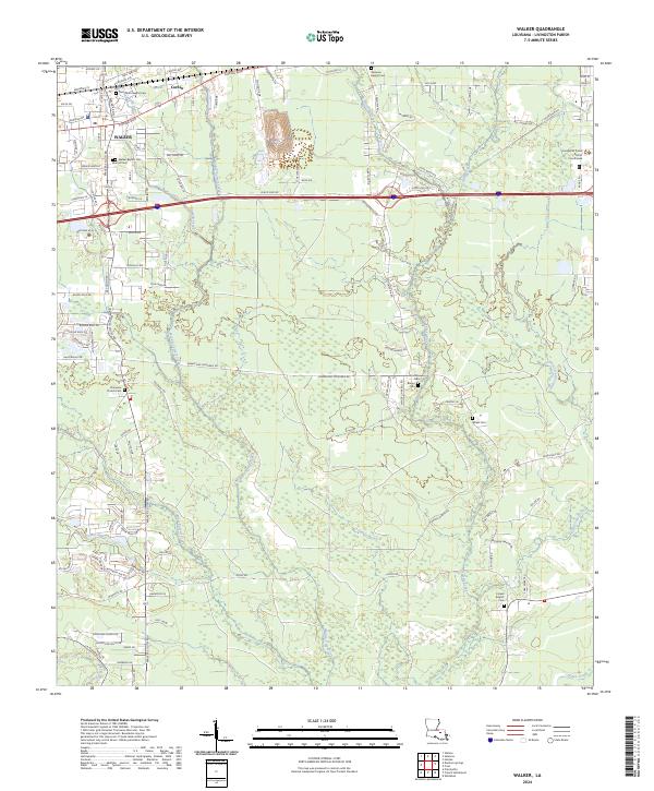
2024 Map of Walker
USGS Topo · Published 2024About this map
Walker and the nearby settlements of Corbin and Satsuma anchor this landscape, where the Livingston Parish District Courthouse stands as a central civic landmark. The terrain is defined by a dense network of waterways, including Middle Colyell Creek, Prairie Bayou, and Grays Creek, which wind through the lowlands. The distribution of family and church burying grounds, such as the Walker Baptist Cem, Wheat Cem, and Ed Andrews Cem, provides significant genealogical touchpoints across the parish. Infrastructure like Florida Blvd and E Railroad Ave illustrates the historical and modern transportation corridors that have shaped local development. The map meticulously records the transition from town centers to more secluded areas near Felder Bayou, offering a clear view of the area's residential and rural composition.
Find a feature on this map
86 named features on this map. Tap any name to fly to it.
Don’t see what you’re looking for? This feature index may not catch every label — zoom into the map to look around manually.
Map Details
Editions of this 2024 Walker Map
This is the sole edition of this map. No revisions or reprints were ever made.
Other maps of this area

1934 · Denham Springs
USGS Topo · 1:62,500

1934 · Springfield
USGS Topo · 1:62,500

1939 · Springfield
USGS Topo · 1:62,500

1939 · Denham Springs
USGS Topo · 1:62,500

1942 · Watson
USGS Topo · 1:31,680

1942 · Satsuma
USGS Topo · 1:31,680

1950 · Doyle
USGS Topo · 1:31,680

1953 · Walker
USGS Topo · 1:24,000
1953 · Prairieville
USGS Topo · 1:24,000
1953 · French Settlement
USGS Topo · 1:24,000