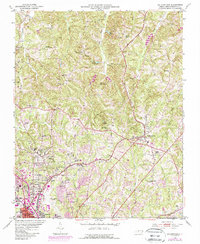
1951 Map of Walkertown
USGS Topo · Published 1987About this map
Walkertown serves as the primary hub of this Forsyth County landscape, where the agricultural past of the 1950s meets the mid-century expansion of Winston-Salem. The map documents a dense network of rural infrastructure, from the Norfolk and Western and Southern rail lines to numerous community anchors like Morris Chapel and the Memorial Industrial Sch. The terrain is defined by the drainage of Buffalo Creek and Belews Creek, punctuated by recreation and youth camps including Camp Betty Hastings and Camp Lasater. Of particular interest to local historians are the many family and church-affiliated burial grounds, such as Banner Cem and Woodland Cemetery, which provide a clear genealogical record of the families who settled this region before modern suburban growth transformed the areas around Smith Reynolds Airport.
Find a feature on this map
55 named features on this map. Tap any name to fly to it.
Don’t see what you’re looking for? This feature index may not catch every label — zoom into the map to look around manually.
Map Details
Editions of this 1951 Walkertown Map
5 editions found
Other maps of this area

1950 · Winston-Salem West
USGS Topo · 1:24,000

1950 · Winston-Salem East
USGS Topo · 1:24,000

1951 · Winston-Salem West
USGS Topo · 1:24,000

1951 · Winston-Salem East
USGS Topo · 1:24,000

1951 · Rural Hall
USGS Topo · 1:24,000

1951 · Walkertown
USGS Topo · 1:24,000

1953 · Winston-Salem
USGS Topo · 1:250,000

1955 · Winston-Salem
USGS Topo · 1:250,000

1962 · Winston-Salem
USGS Topo · 1:250,000

1964 · King
USGS Topo · 1:24,000