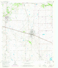
1960 Map of Waller
USGS Topo · Published 1980About this map
Prairie View A & M College dominates the northwestern portion of this landscape, its campus at Prairie View featuring an Athletic Field and localized infrastructure. The town of Waller serves as a central hub, situated where the Texas and New Orleans railroad line, also marked as the Southern Pacific, cuts across the terrain. This rail corridor influenced the early development of the region, connecting smaller nodes like Kulhanek to the broader agricultural and transport network of the county.
Find a feature on this map
27 named features on this map. Tap any name to fly to it.
Don’t see what you’re looking for? This feature index may not catch every label — zoom into the map to look around manually.
Map Details
Editions of this 1960 Waller Map
4 editions found

Other maps of this area

1916 · Hockley
USGS Topo · 1:24,000

1916 · Swanson
USGS Topo · 1:24,000

1919 · Swanson
USGS Topo · 1:31,680

1920 · Hockley
USGS Topo · 1:31,680

1920 · Waller
USGS Topo · 1:31,680

1950 · Houston
USGS Topo · 1:250,000

1953 · Seguin
USGS Topo · 1:250,000

1954 · Beaumont
USGS Topo · 1:250,000

1954 · Austin
USGS Topo · 1:250,000

1955 · Brookshire
USGS Topo · 1:62,500