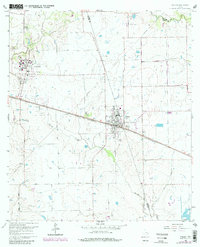
1960 Map of Waller
USGS Topo · Published 1980About this map
Waller and Prairie View anchor this topographic survey along the Waller Co Harris Co line. The landscape is defined by the vital rail corridors of the Texas and New Orleans and Southern Pacific railroads, which parallel major thoroughfares through the coastal prairie. The presence of Prairie View A & M College in the northwest corner highlights a significant institutional center, while the surrounding rural acreage is punctuated by family-named sites and landmarks like Shiloh Ch, St Marys Ch, and Mathis Cem.
Find a feature on this map
20 named features on this map. Tap any name to fly to it.
Don’t see what you’re looking for? This feature index may not catch every label — zoom into the map to look around manually.
Map Details
Editions of this 1960 Waller Map
4 editions found

Other maps of this area

1916 · Hockley
USGS Topo · 1:24,000

1916 · Swanson
USGS Topo · 1:24,000

1919 · Swanson
USGS Topo · 1:31,680

1920 · Hockley
USGS Topo · 1:31,680

1920 · Waller
USGS Topo · 1:31,680

1950 · Houston
USGS Topo · 1:250,000

1953 · Seguin
USGS Topo · 1:250,000

1954 · Beaumont
USGS Topo · 1:250,000

1954 · Austin
USGS Topo · 1:250,000

1955 · Brookshire
USGS Topo · 1:62,500