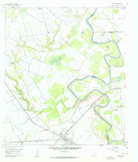
1960 Map of Wallis
USGS Topo · Published 1961About this map
The town of Wallis serves as the focal point of this 1960 survey, situated at the junction of two major rail lines. The Gulf Colorado and Santa Fe and the Texas and New Orleans railroads cross near the center of town, defining the local economy and settlement patterns during this era. This confluence of rail traffic supported a network of rural communities and institutions, including the Williams School and Wallis Cemetery.
Find a feature on this map
33 named features on this map. Tap any name to fly to it.
Don’t see what you’re looking for? This feature index may not catch every label — zoom into the map to look around manually.
Map Details
Editions of this 1960 Wallis Map
3 editions found
Other maps of this area

1950 · Houston
USGS Topo · 1:250,000

1953 · Seguin
USGS Topo · 1:250,000

1955 · Brookshire
USGS Topo · 1:62,500

1955 · Richmond
USGS Topo · 1:62,500

1956 · Sealy
USGS Topo · 1:62,500

1956 · Wallis
USGS Topo · 1:62,500

1956 · Houston
USGS Topo · 1:250,000

1958 · Seguin
USGS Topo · 1:250,000

1960 · Lissie
USGS Topo · 1:24,000

1960 · Wallis
USGS Topo · 1:24,000