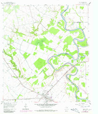
1960 Map of Wallis
USGS Topo · Published 1980About this map
Wallis serves as a vital rail hub in this 1960 survey, situated at the busy intersection of the Gulf Colorado and Santa Fe and the Texas and New Orleans railroads. The town's grid is dense with local institutions, including the Williams School and Evans Chapel. Outside the settlement, the landscape is defined by the winding Brazos River, which forms the boundary between Austin, Waller, and Fort Bend counties.
Find a feature on this map
32 named features on this map. Tap any name to fly to it.
Don’t see what you’re looking for? This feature index may not catch every label — zoom into the map to look around manually.
Map Details
Editions of this 1960 Wallis Map
3 editions found
Other maps of this area

1950 · Houston
USGS Topo · 1:250,000

1953 · Seguin
USGS Topo · 1:250,000

1955 · Brookshire
USGS Topo · 1:62,500

1955 · Richmond
USGS Topo · 1:62,500

1956 · Sealy
USGS Topo · 1:62,500

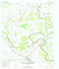
1956 · Wallis
USGS Topo · 1:62,500

1956 · Houston
USGS Topo · 1:250,000

1958 · Seguin
USGS Topo · 1:250,000

1960 · Lissie
USGS Topo · 1:24,000

1960 · Wallis
USGS Topo · 1:24,000