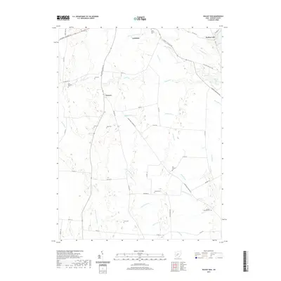
2019 Map of Walnut Run
USGS Topo · Published 2019About this map
The agrarian landscape of Madison County unfolds across this contemporary survey, centered on the unincorporated settlement of Newport. This area is defined by a dense network of drainage ditches and creeks that support the local agricultural economy, including Walnut Run, Bradford Cr, and Roberts Ditch. These waterways carve through the terrain, illustrating the sophisticated water management systems required for farming in the central Ohio till plains.
Find a feature on this map
57 named features on this map. Tap any name to fly to it.
Don’t see what you’re looking for? This feature index may not catch every label — zoom into the map to look around manually.
Map Details
Editions of this 2019 Walnut Run Map
This is the sole edition of this map. No revisions or reprints were ever made.
Other maps of this area

1906 · Mt Sterling
USGS Topo · 1:62,500

1907 · London
USGS Topo · 1:62,500

1907 · South Charleston
USGS Topo · 1:62,500

1916 · Octa
USGS Topo · 1:62,500

1944 · Octa
USGS Topo · 1:62,500

1947 · Columbus
USGS Topo · 1:250,000

1961 · Columbus
USGS Topo · 1:250,000
1961 · Vienna
USGS Topo · 1:24,000
1961 · West Jefferson
USGS Topo · 1:24,000
1961 · London
USGS Topo · 1:24,000