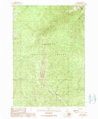
1989 Map of Warren
USGS Topo · Published 1990About this map
Warren serves as the focal point for this mountain landscape, located at the confluence of several high-elevation drainages. The settlement's connection to the local mining and aviation history is evident through the presence of the Warren Airport and the Rescue Mine, situated along the winding course of Warren Creek. This area, heavily managed by the Payette National Forest, shows a complex network of resource-based activity, from the Warren Guard Station to the numerous gulches and creeks that define the drainage patterns of the Salmon River country.
Find a feature on this map
30 named features on this map. Tap any name to fly to it.
Don’t see what you’re looking for? This feature index may not catch every label — zoom into the map to look around manually.
Map Details
Editions of this 1989 Warren Map
2 editions found
Other maps of this area

1956 · Burgdorf
USGS Topo · 1:62,500

1956 · Warren
USGS Topo · 1:62,500

1956 · Elk City
USGS Topo · 1:250,000

1960 · Elk City
USGS Topo · 1:250,000

1969 · Loon Lake
USGS Topo · 1:24,000

1969 · Pony Meadows
USGS Topo · 1:24,000

1969 · Pilot Peak
USGS Topo · 1:24,000

1981 · Warren
USGS Topo · 1:100,000
1989 · Mackay Bar
USGS Topo · 1:24,000
1989 · Johnson Butte
USGS Topo · 1:24,000