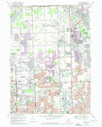
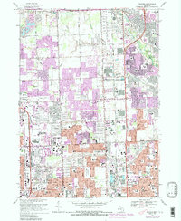
1968 Map of Warren
USGS Topo · Published 1974About this map
Sterling Heights and Warren emerge as significant suburban centers in this late-1960s survey, updated with purple-tinted urban extensions through 1973. The landscape is a mix of established residential grids and industrial infrastructure, where the Clinton River and Plum Brook provide natural breaks in the developing sprawl. The area is defined by its rigorous grid of thoroughfares, including Van Dyke and Mound Road, which facilitated the rapid growth of post-war housing and manufacturing. Notable for genealogists and local historians are the numerous educational facilities like Cousino High School and Stevenson High School, alongside religious landmarks such as St. Basil Church. The presence of the Big Beaver Airport and the Dodge Bros State Park No. 4 highlights the era's balance of early aviation utility and dedicated public recreation space near the heart of the Detroit metropolitan area.
Find a feature on this map
150 named features on this map. Tap any name to fly to it.
Don’t see what you’re looking for? This feature index may not catch every label — zoom into the map to look around manually.
Map Details
Editions of this 1968 Warren Map
5 editions found
Other maps of this area

1905 · Detroit
USGS Topo · 1:62,500

1905 · Grosse Pointe
USGS Topo · 1:62,500

1908 · Rochester
USGS Topo · 1:62,500

1912 · Mt Clemens
USGS Topo · 1:62,500

1918 · Detroit
USGS Topo · 1:62,500

1918 · Grosse Pointe
USGS Topo · 1:62,500

1924 · Detroit
USGS Topo · 1:62,500

1929 · Mt Clemens
USGS Topo · 1:62,500

1934 · Detroit
USGS Topo · 1:62,500

1936 · Warren
USGS Topo · 1:31,680