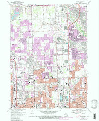
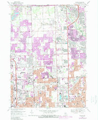
1968 Map of Warren
USGS Topo · Published 1989About this map
The Clinton River and its various tributaries like Plum Brook and Bear Creek carve through this rapidly urbanizing corridor of Macomb and Oakland counties. By the late 1960s, the transition from agricultural land to dense suburban residential and commercial hubs is evident, particularly around the expansion of Sterling Heights and Warren. Significant local landmarks include the Big Beaver Airport and the sprawling Oakland Mall Shopping Center, while public spaces like Dodge Bros State Park No 8 provide preserved green space along the river bend.
Find a feature on this map
104 named features on this map. Tap any name to fly to it.
Don’t see what you’re looking for? This feature index may not catch every label — zoom into the map to look around manually.
Map Details
Editions of this 1968 Warren Map
5 editions found
Other maps of this area

1905 · Detroit
USGS Topo · 1:62,500

1905 · Grosse Pointe
USGS Topo · 1:62,500

1908 · Rochester
USGS Topo · 1:62,500

1912 · Mt Clemens
USGS Topo · 1:62,500

1918 · Detroit
USGS Topo · 1:62,500

1918 · Grosse Pointe
USGS Topo · 1:62,500

1924 · Detroit
USGS Topo · 1:62,500

1929 · Mt Clemens
USGS Topo · 1:62,500

1934 · Detroit
USGS Topo · 1:62,500

1936 · Warren
USGS Topo · 1:31,680