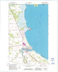
1967 Map of Warroad
USGS Topo · Published 1995About this map
Warroad serves as a critical northern port and border entry point on this topographic study, where the Warroad River meets the expansive Lake of the Woods. The landscape is defined by the intersection of water and international diplomacy, with the Canada United States boundary cutting across the northern waters through Elm Point. Evidence of the region’s specialized infrastructure is visible in the U S Customhouse and the Warroad Airfield, highlighting the town's role as a gateway between nations.
Find a feature on this map
25 named features on this map. Tap any name to fly to it.
Don’t see what you’re looking for? This feature index may not catch every label — zoom into the map to look around manually.
Map Details
Editions of this 1967 Warroad Map
3 editions found
Other maps of this area

1918 · Buffalo Bay
USGS Topo · 1:62,500

1918 · Roosevelt
USGS Topo · 1:62,500

1918 · Warroad
USGS Topo · 1:62,500

1943 · Roosevelt
USGS Topo · 1:62,500

1943 · Warroad
USGS Topo · 1:62,500

1954 · Roseau
USGS Topo · 1:250,000

1957 · Roseau
USGS Topo · 1:250,000

1958 · Roseau
USGS Topo · 1:250,000

1963 · Kenora
USGS Topo · 1:250,000

1967 · Roosevelt NW
USGS Topo · 1:24,000