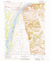
1964 Map of Warsaw
USGS Topo · Published 1970About this map
The Mississippi River dominates this mid-1960s landscape where the borders of Illinois and Missouri meet. Along the eastern bluffs, the town of Warsaw is a focal point of settlement, characterized by its residential grid and local landmarks like Oakland Cemetery and the Warsaw Airport. Across the water in Missouri, the village of Alexandria sits near the confluence of Pickle House Slough and the Fox River, a low-lying area defined by complex waterways and drainage patterns.
Find a feature on this map
48 named features on this map. Tap any name to fly to it.
Don’t see what you’re looking for? This feature index may not catch every label — zoom into the map to look around manually.
Map Details
Editions of this 1964 Warsaw Map
3 editions found
Other maps of this area

1903 · Kahoka
USGS Topo · 1:125,000

1936 · Keokuk
USGS Topo · 1:62,500

1946 · Mendon
USGS Topo · 1:62,500

1948 · Mendon
USGS Topo · 1:62,500

1949 · Wayland
USGS Topo · 1:24,000

1949 · Kahoka SE
USGS Topo · 1:24,000

1950 · Kahoka SE
USGS Topo · 1:24,000

1950 · Wayland
USGS Topo · 1:24,000

1950 · Keokuk
USGS Topo · 1:62,500

1950 · Canton
USGS Topo · 1:24,000