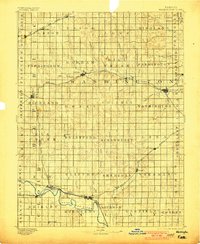
1893 Map of Washington
USGS Topo · Published 1901About this map
The Republican River winds through the southern reaches of this agricultural landscape, anchoring a network of early settlements connected by an expanding rail system in the late nineteenth century. Established towns such as Washington, Clyde, and Clifton serve as regional hubs, while smaller rail stops like Haddam, Linn, and Cuba highlight the density of the rural population at this time. The map documents the competitive rail era with the Chicago Rock Island and Pacific Railway and the Union Pacific Railway carving paths across the rolling terrain. Beyond the towns, the land is meticulously divided into townships including Strawberry, Brantford, and Haddam, revealing a frontier that has been fully transitioned into a surveyed, agrarian economy. Many of these points, such as Morrow and Emmons, provide critical data for tracing local family history and the evolution of North Central Kansas transport.
Find a feature on this map
80 named features on this map. Tap any name to fly to it.
Don’t see what you’re looking for? This feature index may not catch every label — zoom into the map to look around manually.
Map Details
Editions of this 1893 Washington Map
4 editions found
Other maps of this area

1886 · Junction City
USGS Topo · 1:125,000

1889 · Marysville
USGS Topo · 1:125,000

1889 · Junction City
USGS Topo · 1:125,000

1891 · Clay Center
USGS Topo · 1:125,000

1892 · Concordia
USGS Topo · 1:125,000

1892 · Minneapolis
USGS Topo · 1:125,000

1893 · Washington
USGS Topo · 1:125,000

1894 · Junction City
USGS Topo · 1:125,000

1894 · Marysville
USGS Topo · 1:125,000

1898 · Hebron
USGS Topo · 1:125,000