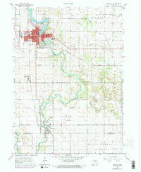
1963 Map of Waverly
USGS Topo · Published 1973About this map
Waverly and its surroundings serve as a focal point for this mid-century look at Bremer County, where the Cedar River meanders south toward Janesville. The landscape is a mix of educational institutions like Wartburg College, healthcare facilities such as Mercy Hospital, and numerous civic spaces including the large Harlington Cemetery. Local infrastructure is defined by the Illinois Central Railroad and the Chicago and North Western lines, which supported the region's agricultural and industrial transport.
Find a feature on this map
47 named features on this map. Tap any name to fly to it.
Don’t see what you’re looking for? This feature index may not catch every label — zoom into the map to look around manually.
Map Details
Editions of this 1963 Waverly Map
Other maps of this area

1954 · Waterloo
USGS Topo · 1:250,000

1955 · Waterloo
USGS Topo · 1:250,000

1963 · Waverly
USGS Topo · 1:24,000

1963 · Denver
USGS Topo · 1:24,000

1963 · Cedar Falls
USGS Topo · 1:24,000

1963 · Waterloo North
USGS Topo · 1:24,000

1971 · Shell Rock
USGS Topo · 1:24,000

1971 · Bremer
USGS Topo · 1:24,000

1971 · Plainfield
USGS Topo · 1:24,000

1971 · Tripoli
USGS Topo · 1:24,000