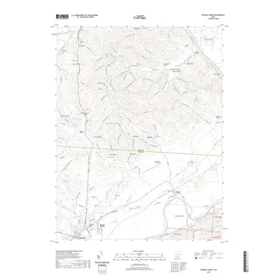
2019 Map of Waverly North
USGS Topo · Published 2019About this map
Waverly serves as a focal point along the Scioto River in this 2019 study, where the river's broad valley meets the complex ridge systems of the Ross and Pike county line. The landscape is defined by its numerous named drainages and hollows, such as Rhine Hollow, Woods Hollow, and Webb Hollow, which characterize the upland terrain surrounding the river flats. Transportation and recreational networks are prominent, including the N Country National Scenic Trail and the extensive Scioto Trail bridle trail winding through the forested hills.
Find a feature on this map
119 named features on this map. Tap any name to fly to it.
Don’t see what you’re looking for? This feature index may not catch every label — zoom into the map to look around manually.
Map Details
Editions of this 2019 Waverly North Map
This is the sole edition of this map. No revisions or reprints were ever made.
Other maps of this area

1906 · Waverly
USGS Topo · 1:62,500

1906 · Chillicothe
USGS Topo · 1:62,500

1908 · Chillicothe
USGS Topo · 1:62,500

1908 · Waverly
USGS Topo · 1:62,500

1912 · Roxabell
USGS Topo · 1:62,500

1914 · Roxabell
USGS Topo · 1:62,500

1915 · Piketon
USGS Topo · 1:62,500

1917 · Piketon
USGS Topo · 1:62,500

1944 · Piketon
USGS Topo · 1:62,500

1944 · Roxabell
USGS Topo · 1:62,500