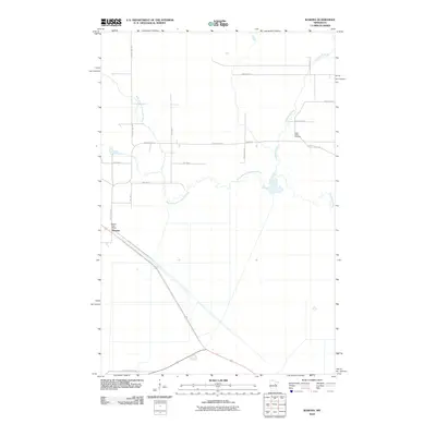
2010 Map of Wawina
USGS Topo · Published 2010About this map
Wawina anchors this northern Minnesota landscape, a small settlement defined by its proximity to the winding watercourses of the Floodwood River and the West Branch Floodwood River. The community's infrastructure includes the centrally located Wawina Post Office, serving as a focal point for the surrounding rural townships. To the north and east, the map reveals a network of local thoroughfares such as Van Horn Rd, Froehlich Rd, and Hinkkanen Rd, illustrating the grid of section-line roads that organize this low-lying terrain. The southern portion of the quadrangle transitions into the protected lands of the Savanna State Frst, while the presence of the Cedar Valley Cemetery provides a specific point of interest for genealogists tracing local families. This map records the late-twentieth-century spatial arrangement of a region where the natural river systems and managed timberlands remain the dominant geographical features.
Find a feature on this map
20 named features on this map. Tap any name to fly to it.
Don’t see what you’re looking for? This feature index may not catch every label — zoom into the map to look around manually.
Map Details
Editions of this 2010 Wawina Map
This is the sole edition of this map. No revisions or reprints were ever made.
Other maps of this area

1953 · Duluth
USGS Topo · 1:250,000

1954 · Hibbing
USGS Topo · 1:250,000

1957 · Hibbing
USGS Topo · 1:250,000

1958 · Hibbing
USGS Topo · 1:250,000

1958 · Duluth
USGS Topo · 1:250,000

1963 · Toivola SW
USGS Topo · 1:24,000

1963 · Upstead Lake
USGS Topo · 1:24,000
1963 · Floodwood
USGS Topo · 1:24,000

1964 · Hibbing
USGS Topo · 1:250,000

1969 · Wawina
USGS Topo · 1:24,000