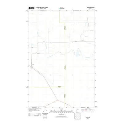
2013 Map of Wawina
USGS Topo · Published 2013About this map
The settlement of Wawina anchors this 2013 survey of northeastern Minnesota, situated at the junction of Us-2 and Co Hwy-25. The landscape is defined by the winding course of the Floodwood River and its western tributary, the W Br Floodwood River, which snake through the low-lying terrain near the meeting point of Itasca, St. Louis, and Aitkin Counties. The small community includes a Po and is surrounded by a network of rural township roads that reflect a sparse, timber-influenced settlement pattern.
Find a feature on this map
23 named features on this map. Tap any name to fly to it.
Don’t see what you’re looking for? This feature index may not catch every label — zoom into the map to look around manually.
Map Details
Editions of this 2013 Wawina Map
This is the sole edition of this map. No revisions or reprints were ever made.
Other maps of this area

1953 · Duluth
USGS Topo · 1:250,000

1954 · Hibbing
USGS Topo · 1:250,000

1957 · Hibbing
USGS Topo · 1:250,000

1958 · Hibbing
USGS Topo · 1:250,000

1958 · Duluth
USGS Topo · 1:250,000

1963 · Toivola SW
USGS Topo · 1:24,000

1963 · Upstead Lake
USGS Topo · 1:24,000
1963 · Floodwood
USGS Topo · 1:24,000

1964 · Hibbing
USGS Topo · 1:250,000

1969 · Wawina
USGS Topo · 1:24,000