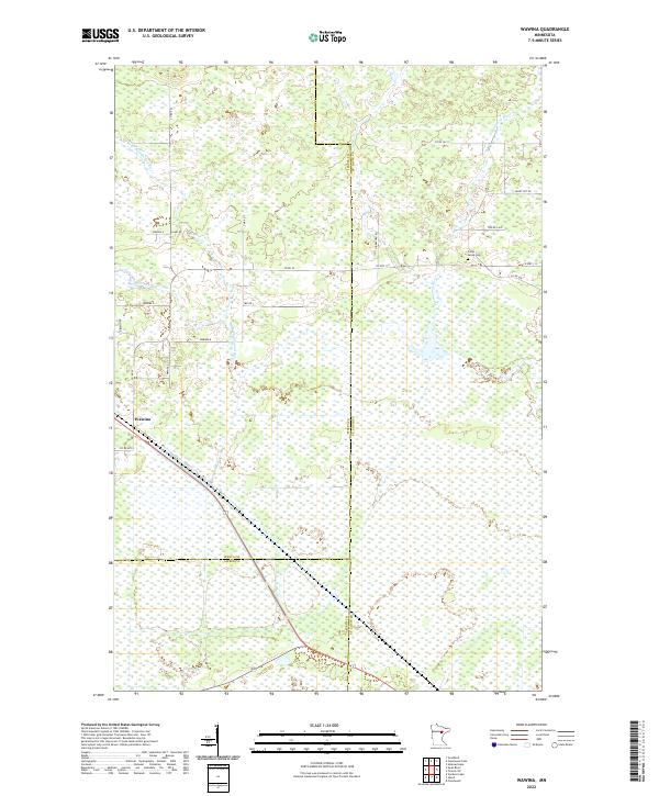
2022 Map of Wawina
USGS Topo · Published 2022About this map
Wawina serves as the central point of interest in this Minnesota landscape, where the confluence of Itasca, St. Louis, and Aitkin counties meets. This modern survey illustrates a terrain defined by the complex hydrology of the W Br Floodwood River and the main Floodwood River, which wind through extensive wetlands. The road network, including family and local-named routes like Aari Rd and Hinkkanen Rd, suggests a sparse, rural settlement pattern typical of the region. The map provides a clear look at the Cedar Valley Cem, a key landmark for genealogical research. A series of labeled local roads such as Wawina E, Wawina D, and Wawina B branch out from the town center, tracing the access points into the surrounding bog and timber lands.
Find a feature on this map
30 named features on this map. Tap any name to fly to it.
Don’t see what you’re looking for? This feature index may not catch every label — zoom into the map to look around manually.
Map Details
Editions of this 2022 Wawina Map
This is the sole edition of this map. No revisions or reprints were ever made.
Other maps of this area

1953 · Duluth
USGS Topo · 1:250,000

1954 · Hibbing
USGS Topo · 1:250,000

1957 · Hibbing
USGS Topo · 1:250,000

1958 · Hibbing
USGS Topo · 1:250,000

1958 · Duluth
USGS Topo · 1:250,000

1963 · Toivola SW
USGS Topo · 1:24,000

1963 · Upstead Lake
USGS Topo · 1:24,000
1963 · Floodwood
USGS Topo · 1:24,000

1964 · Hibbing
USGS Topo · 1:250,000

1969 · Wawina
USGS Topo · 1:24,000